Alexandra Lamiña
Geographer, Urban Planner, and Amazonia Advocate

Indigenous Geospatial Mobility: Agency, Gender, and Urbanization in Ecuadorian Amazonia.
My current project investigates the Kichwa Indigenous mobilities, resurgence actions, and practices of Indigenous planning involved in the settler-colonial urban transformation in Amazonia. To conduct this study, I develop an Indigenous geo-ethnographic approach that centers south-north scholarly dialogue in support of the Indigenous struggles. I also draw on critical pedagogies favoring a community capacity-building process and recognizing participants as co-researchers in democratic learning processes. My engaged scholarship includes training and knowledge co-production with Kichwa women in geospatial research to connect south-north perspectives with urban development praxis.
Photo: Amazonian Kichwa women working on body-mappings, Puyo city. 2022.
Amazonia Miray Institute
Co-founder and current staff member. I am a Geographer and Urban Planner at the Center of the Kichwa Ethnogeography. This community-based organization supports projects and develops research in Indigenous geographies for women and young people and Indigenous planning in rural and urban areas. We have collaborated in various advocacy actions, scholarly publications, media presence, workshops, and other efforts thanks to this collective initiative in Amazonia.
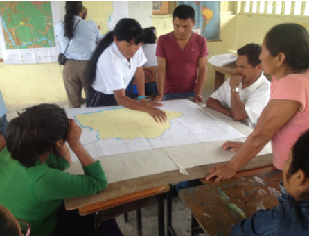
Photo: Community workshops to discuss territorial management, San Jacinto Comuna, 2012.

Insurgent Planning in the Dominican Republic
This project is a UT-Austin course-based initiative that works with students in collaborative research and active engagement with community partners, activists, and public officials. The goal is to challenge official neglect and marginalization by developing insurgent, community-based solutions to socioenvironmental problems facing informal areas in the Dominican Republic. I am an active member of this working group who continues collaborating through scholarly publications.
Photo: Los Platanitos community and UT students participating in a conference, Domican Republic, 2015.
Indigenous Participatory Mapmaking
The Initiative on Participatory Mapping is building a network of scholars, practitioners, and community leaders throughout the Americas. We are engaged in various aspects of participatory mapping and bring a diversity of experiences and perspectives based on specific national and regional contexts. This expanding group pursues its continuing dialogue through conferences and workshops, collaborative field research, and joint publications.
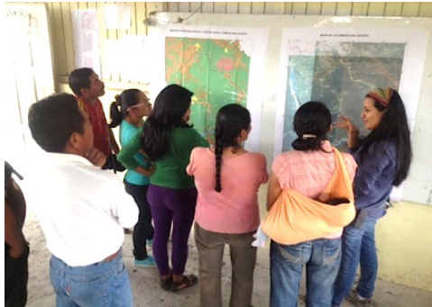
Photo: Cartographic workshops in San Jacinto comuna, 2012.
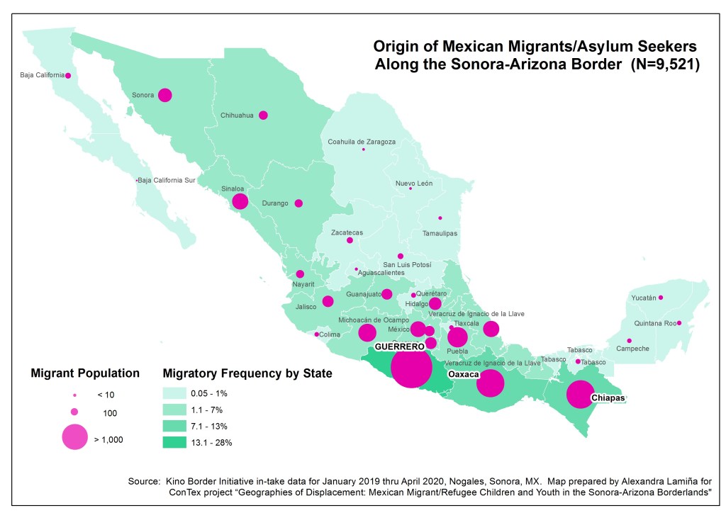
Geographies of Displacement: Mexican Migrant/Refugee Children and Youth in the Sonora-Arizona Borderlands
In 2020-21, I worked closely with Dr. Rebecca Torres, Dr. Caroline Faria, and international researchers from “El Colegio de Mexico” to design and build a geospatial database to analyze the migratory processes of children and young people in the Sonora-Arizona borderlands. This project builds a binational interdisciplinary working group of scholars and advocates focused on displaced Mexican Migrant/Refugee children and youth.
Map: Origin of Mexican Migrants. ConTex Project, 2021.
Participatory Action Research in Community Development in Mexico.
In 2015-16, I collaborated with the Practicum Participatory Action Research in Mexico. This collaborative work aimed to increase community self-governance and environmental sustainability using participatory workshops, design thinking, rapid prototyping, and reflective practice. This community-based action was supported by academic partners and local governments.
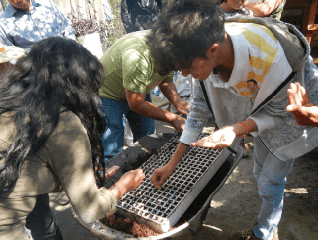
Photo: Young collectives working on environmental sustainability actions, 2016.